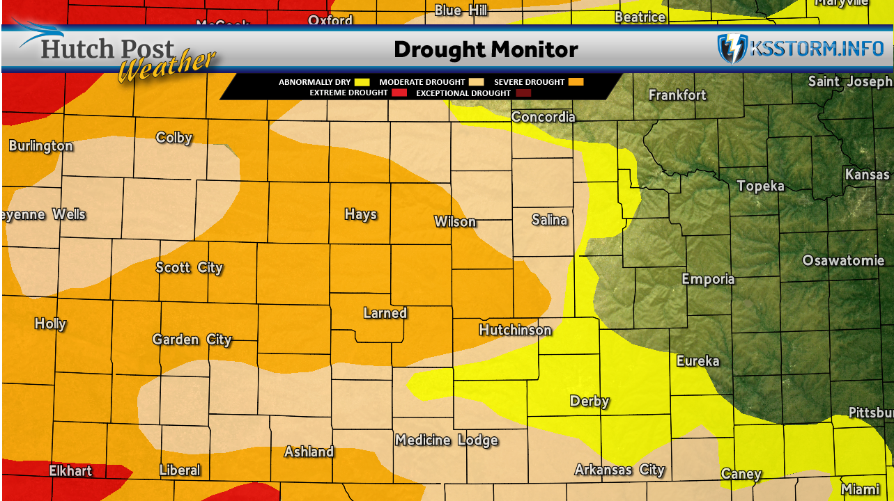
HUTCHINSON, Kan. — The latest weekly U.S. Drought Monitor shows worsening conditions across much of Kansas and the central Plains, as a dry and unusually warm spring continues to take a toll on soil moisture and vegetation.
According to the report, most of the region saw little to no precipitation over the past week. Only isolated rainfall was recorded in far southeast Nebraska, northern and southeast Kansas, and small portions of Colorado and North Dakota. Meanwhile, temperatures across the region trended above normal, with the greatest departures noted in eastern Kansas and southeast Nebraska.
Those conditions contributed to widespread drought degradation across the High Plains.
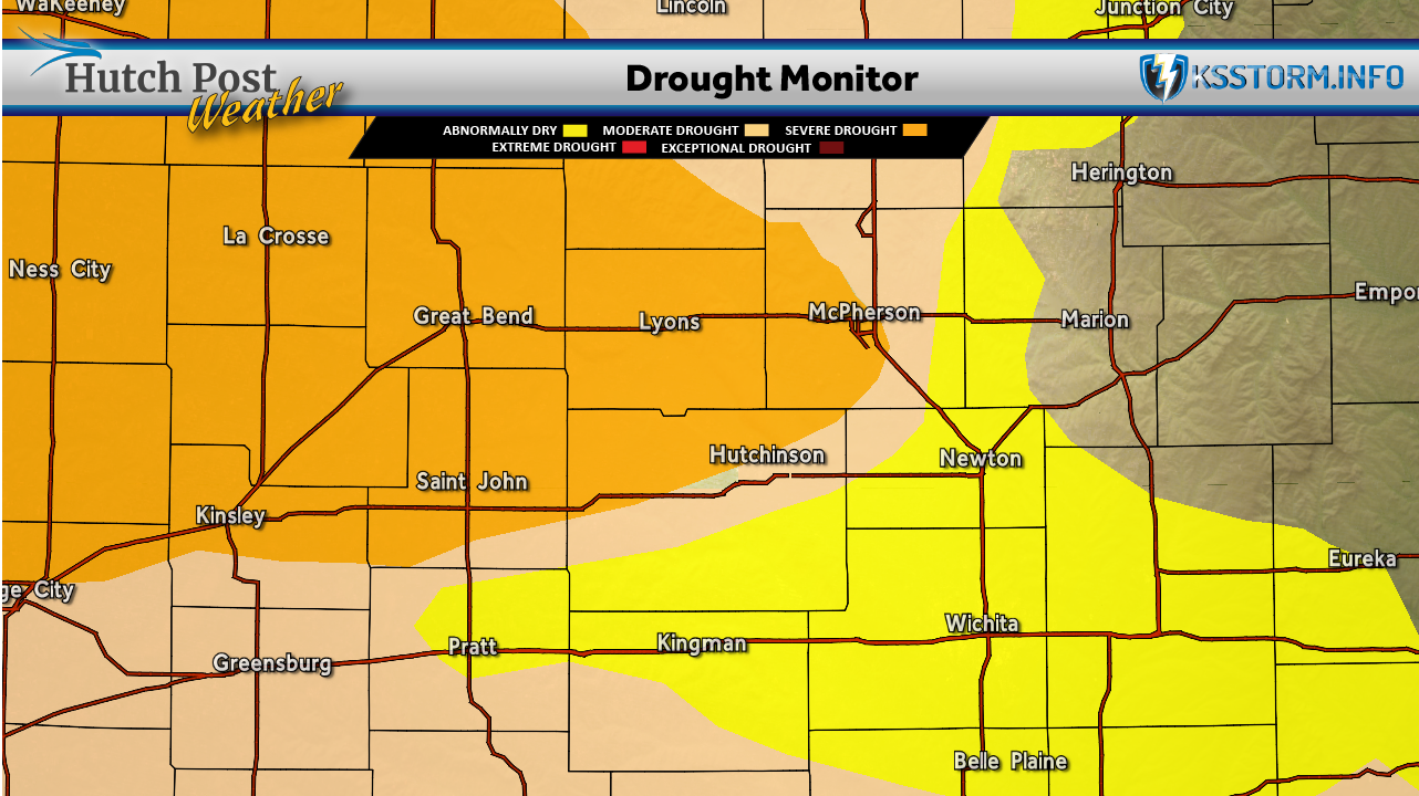
In Kansas, severe drought expanded across central and southwest portions of the state. Additionally, new areas of extreme drought were introduced in far southwest Kansas, signaling intensifying dryness in that region. Northwest Kansas also saw impacts tied to expanding extreme drought conditions pushing in from Nebraska.
The situation was even more pronounced to the north, where extreme drought grew across central and western Nebraska.

Elsewhere across the Plains, drought conditions also worsened. Wyoming and Colorado experienced continued degradation, with moderate to extreme drought expanding across large portions of both states. Southern South Dakota also reported the introduction of extreme drought.
Despite the overall trend, there was some limited improvement in parts of southeast Kansas. Recent rainfall helped reduce areas classified as moderate drought and abnormally dry, offering some short-term relief.
However, forecasters warn that continued above-normal temperatures and limited precipitation could further intensify drought conditions heading into late spring and early summer, particularly across western and central Kansas where impacts are already growing.
The U.S. Drought Monitor is jointly produced by the National Drought Mitigation Center at the University of Nebraska-Lincoln, the United States Department of Agriculture, the National Oceanic and Atmospheric Administration and the National Aeronautics and Space Administration. Map data couresy of NDMC.