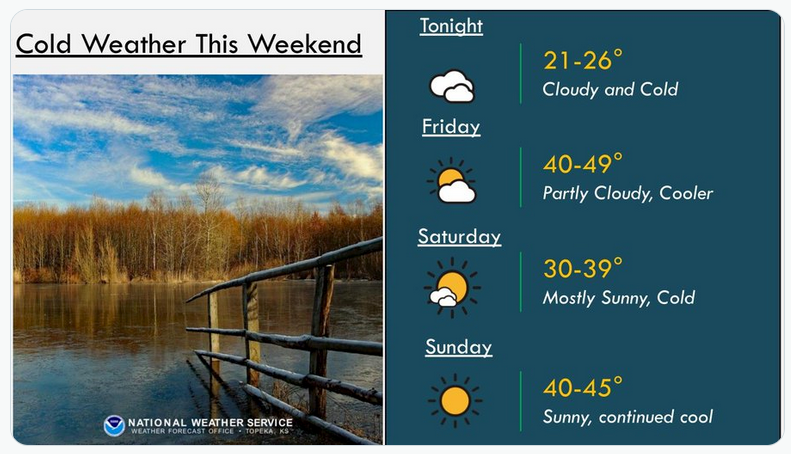
Cooler air should stick around through the weekend, the National Weather Service in Topeka said.
Thursday's front brought about a quarter-inch of rain to the area, followed by a period of light snow only measured as trace.
The high Saturday is only expected to be in the low- to mid-30s, with an overnight low in the low-teens.
The mercury will start to tick back up Saturday, with a high in the mid-40s, and warmer air will return by Monday, with a high in the upper-50s.
Winds will persist through the weekend, sustained at 10 to 15 mph and gusting to 20 to 25 mph.
The next chance of precipitation in the long-term forecast is a slight chance of rain Tuesday through Thursday.